The Yamalo-Nenets Autonomous Okrug is a national state entity. The district was created on December 10, 1930. As an equal subject, the district is part of the Russian Federation. The administrative center of the district is the city of Salekhard.
The area of the district is 750.3 thousand km2. Its territory could accommodate Spain, Portugal and Greece combined.
The total population of the district is more than 508 thousand people. The most densely populated areas are along railways and river transport arteries. The average population density of the district is less than 1 person per 1 km2. The industrial development of the district in recent decades has contributed to the rapid growth of the urban population (more than 85% of the total number of residents of the district)
Now in the Yamalo-Nenets Okrug there are 8 cities of district subordination - these are Salekhard, Labytnangi, Muravlenko, Nadym, Novy Urengoy, Noyabrsk, Tarko-Sale and Gubkinsky, 7 urban-type settlements: Korotchaevo, Limbayakha, Pangody, Stary Nadym, Tazovsky, Urengoy, Kharp and 103 small rural settlements.. The number of rural residents is declining due to the transformation of rural settlements into urban ones and as a result of the outflow of population from rural areas. Among rural Yamal settlements, non-agricultural (rotational, oil and gas, transport) and small national settlements (fishing, reindeer herding, hunting) predominate. The number of inhabitants in rural settlements averages 910 people. The presence of mobile settlements of indigenous peoples (pastures, tents, huts) is also characteristic.
SALEKHARD

Salekhard, the capital of the Yamalo-Nenets Autonomous Okrug, is a city in Western Siberia, the center of the Yamalo-Nenets Autonomous Okrug. The city is located 2436 kilometers northeast of Moscow and 1982 kilometers north of Tyumen.
The city of Salekhard is located on the Poluyskaya Upland, on the right bank of the Ob River, at its confluence with the Poluy River, near the Arctic Circle, in the permafrost zone. It is the only city in the world located on the Arctic Circle.
The climate here is sharply continental and harsh. Average temperatures in January are from –22 to – 26 degrees, in July - + 4 - +14 degrees. Precipitation is 200 - 400 mm per year.
The nearest railway station is Labytnangi (line to Kotlas) - 20 km from Salekhard, on the opposite bank of the Ob; It is connected with Salekhard in the summer by a river bus, and in the winter by bus.
The population of modern Salekhard is more than 35.5 thousand inhabitants (end of 2002). Of these, 5 thousand 600 are foreigners and 4 thousand 450 are temporary residents.
Historical information. The city was founded by the Siberian Cossacks more than 400 years ago, or more precisely in 1595, under the name Obdorsk (from the name of the Ob River and the word “dor”, translated from the Komi language - “a place near”, “near something”), however, the Nenets have long been They called the village Sale-Harn, that is, “settlement on the cape.”
In the mid-18th century, merchants came here for fairs, and at the end of the 18th century, the fortress was abolished. Since the 20s of the 19th century, Russians began to settle permanently in Obdorsk.
In the XYII - early XX centuries, Obdorsk became part of the Belozersky district of the Tobolsk province. In 1897, in the village of Obdorsk there were 30 houses, 150 trading shops, and there were 500 permanent residents who were mainly engaged in hunting, fishing and trading. At that time the village was famous for its large fairs. Every year from December 15 to January 25, the Obdorsk Fair was held here (the turnover exceeded 100 thousand rubles). During this period of time, the population of the city exceeded several thousand people. Russian traders, mainly from Tobolsk, brought flour, bread, wine, cloth, iron and copper products, tobacco and jewelry, receiving in return furs, fish and fish glue, bird feathers, mammoth ivory and walrus tusks. The monetary unit was mainly considered to be arctic fox skins and paws.
In 1897, a fishing school was founded in the city of Obdorsk.
In December 1930, the Yamalo-Nenets Autonomous Okrug was formed, the city of Obdorsk became its center, and since 1933 it began to be called Salekhard. The village received city status in 1938. This is the first and only city in the Arctic Circle.
Modern Salekhard is a large cultural and industrialized city.
Industry of the city. There is no serious manufacturing industry in the city and therefore the city is always supported by the district. The city industry is represented by: factories - fish canning and dairy, and a house-building plant.
Salekhard is the center of geological exploration expeditions. This is a major transport hub. The Salekhard fish canning plant is the largest in the Tyumen region and is one of the first-born of the industrial development of the north of Western Siberia.
The city of Salekhard is a large river port. 72 years ago (in 1933) the North Ural Trust of the Main Northern Sea Route was created in Salekhard. He is engaged in shipbuilding, fur harvesting, hunting, and timber exports.
In the city of Salekhard, a mink fur farm has been operating since 1951, where fur-bearing animals are bred - arctic foxes, nutria and minks.
There is also a modern airport, the grand opening of which took place on May 31, 2000. “Iron Birds” fly to many cities in Russia and even abroad (for example, to the city of Budapest. It is also planned to carry out flights to Cyprus and Turkey).
Air communication with the capital of the Tyumen region, the city of Tyumen, was opened back in 1935; in 1937, the first regular air line Salekhard - New Port began operating.
A recently built highway connected the regional capital with other cities and towns of Yamal.
Cultural life of the city. There are five secondary specialized educational institutions in the district center: a pedagogical college, a veterinary technical school, a school of culture and art, a trade school, and the oldest medical school in the country. The medical school has a preparatory department for indigenous northerners.
In 1932, the oldest national pedagogical college in Yamal was opened, which over the years has trained many excellent teaching staff.
There is a local history museum in Salekhard, where local arts and crafts are collected - bone carving, bead jewelry, embroidery and appliqué (a design made using scraps of various materials) on fur, leather and cloth.
In 1990, the city of Salekhard was included in the list of historical cities. A protected historical zone has been created in the city, because there are many buildings of historical and architectural value.
Sports life of the city. Salekhard is a sports city, here almost every resident goes in for sports. This is facilitated by a large number of cultural and sports institutions in the city. The Ice Palace, which recently opened its doors to lovers of active recreation, is very popular. There are so many sections there, and so many competitions that haven’t been held here!
On April 9, 2001, a polar chess school named after world chess champion Anatoly Karpov was opened in the city of Salekhard. Nowadays, chess competitions are held here every year. There is a tennis club in the city with the beautiful name “Polar” (this is a veteran’s club, more than 30 people participate in it). Members of the club - Vladimir Medvedev, Viktor Chikhirev and others - took part in the Russian personal championship and took 8 prizes. There is a children's and youth sports school here, which has trained a lot of sports personnel.
For ski lovers, a ski base has been created in the city, where there is an excellent illuminated ski track and equipped recreation buildings.
Republican championships in national sports are held annually in the capital of the district; they have been held since 1974. This proves that Yamal pays great attention to national sports.
In recent years, the ancient city of Salekhard, which no one has occupied for more than 400 years, can be said to have been born again. Currently, it has become a major cultural and industrial center, with modern, comfortable houses.
The appearance of the district capital is constantly changing, there is a lot of construction going on there and colossal work is being done to improve the urban area. The city amazes today's average citizen with its architectural sophistication and uniqueness. The city has great prospects and plans for the future; according to the leaders of the city and district, it will be a city designed for 40 thousand residents.

 Truly, the age of Siberian cities is considerable. And our city is one of the oldest among them.
Yes, it is comparable in age to Siberian cities. However, it is not comparable - not only with Siberian, but also with all other cities of the world - in terms of its geographical location. Salekhard (formerly Obdorsk) is the only city in the world located directly on the Arctic Circle. The only one... But he is not spoiled by Mother Russia.
The city grew slowly, as if looking with disbelief at the rapid development of its Siberian sister cities, older and younger, which survived the whirlpool of history and disappeared in it. He didn’t want the latter, but rushing towards the former, wanting to survive in life, he was modest and unfussy. He lived with dignity, maintaining a sense of proportion in everything: both in humility and in self-awareness.
The date of birth of Obdorsk is called differently in many sources: in some – 1592 or 1593, and in others – 1595. The difference, of course, in the scale of history is insignificant. Besides 
 Each of the mentioned dates certainly has the right to exist. It all depends on what is considered the founding of Obdorsk: whether the Cossacks came to the lower reaches of the Poluy, the construction of a small winter hut near its confluence with the Ob, or the emergence here of a solid – by the standards of that time – fortification.
Time passed as usual...
And now Salekhard is increasingly gaining strength as the capital of a powerful gas and oil power. It is becoming a real Russian outpost, coordinating the supply of powerful flows of hydrocarbon raw materials not only on the territory of the Russian Federation, but also abroad. Salekhard residents have something to be proud of...
 In recent years, our ancient city, one might say,
  , born again. Literally before our eyes, new five-story buildings are rising, modern highways are being laid, a state-of-the-art airport is being built, and the entire infrastructure of the Yamal capital is rapidly developing. Salekhard's second youth, which came to him as a result of intensive construction, amazes today's average person with its architectural thoughtfulness and uniqueness. Keep it up, Salekhard!
 //Yamal Meridian.-2000.-No.9.-P.24-25

SALEKHARD, center of the Yamalo-Nenets Autonomous Okrug, 2436 km to the north-east. from Moscow and 1982 km north of Tyumen. Located on the Poluyskaya Upland, on the right bank of the river. Ob, at the confluence of the river. Poluy, near the Arctic Circle, in the permafrost zone. The climate is sharply continental and harsh. Average January temperatures from  -22 to - 26°C, July 4-14°C. Precipitation is 200-400 mm per year. Nearest railway station - Labytnangi (line to Kotlas) - 20 km from Salekhard, on the opposite bank of the Ob; It is connected with Salekhard in the summer by a river bus, and in the winter by bus. River port. Airport. Population 30.6 thousand
 people (1992; 13 thousand in 1939; 17 thousand in 1959; 22 thousand in 1970; 25 thousand in 1979). Founded in 1595 as a Cossack fortress (at that time the northernmost in Siberia) under the name. Obdorsk (from the name of the Ob river and the word “dor”, translated from the Komi language - a place near, near something), however, the Nenets have long called the village Sale-Kharn, i.e. a settlement on the cape. From the middle of the 18th century. merchants came here for fairs; at the end of the 18th century. the fortress was abolished. Since the 20s 19th century Russians began to settle permanently in Obdorsk. In the 18th - early 20th centuries.
  became part of the Berezovsky district of the Tobolsk province. In 1897 in Obdorsk there were 30 houses, 150 trading shops, there were 500 permanent residents who were mainly engaged in hunting,
  fishing and trade; Every year from December 15 to January 25, the Obdorsk Fair was held (turnover exceeded 100 thousand rubles); During this period, the population of Obdorsk increased to several thousand people. Russian traders (mainly from Tobolsk) brought flour, bread, wine, cloth, iron and copper products, tobacco and jewelry, receiving in return furs, fish and fish glue, bird feathers, mammoth ivory and walrus tusks. In 1897, a fishing school was founded in Obdorsk. In 1930, the Yamalo-Nenets National District was formed, the center of which was Obdorsk; Since 1933 it has been called Salekhard. The city - since 1938. In modern Salekhard: factories - fish canning, dairy; house-building plant. Timber transshipment base. Salekhard is the organizational center of geological exploration expeditions. Museum of Local Lore (on display are artistic products of local craftsmen: bone carving, embroidery and appliqué on fur, leather and cloth - “malevu”).
Near Salekhard there are sites of the Bronze and Early Iron Ages (2-1st millennium BC).
//Cities of Russia: encyclopedia. – M.:
Great Russian Encyclopedia, 1994. – P.391.
Salekhard(Salyahard), a city on the right bank of the Ob near the Arctic Circle and the mouth of the river. Poluy, center of the Yamalo-Nenets Autonomous Okrug. At the end of the 16th century. in this place was the Obdorsky Nosovoy town, which belonged to the Khanty (Ostyaks). They, according to G.F. Miller, called it Puling-avat-vash - “Poluy Nose Town.” The Nenets (Samoyeds) called it Salia Garden, which translated meant the same thing: “Nose (Cape) Town.” or “City on the nose (cape).” The Komi-Zyryans of the land adjacent to the mouth of the Ob called obdor, i.e. “a place near the Ob” or “the mouth of the Ob” (dor - “a place near something”, “the mouth "). Already in one of the charters of the early 16th century, Grand Duke Vasily Ivanovich is called the Prince of Kondinsky and Obdorsky. Therefore, the Ostyak Nosovoy town was often called the Obdorsky Nosovoy town. The Russians, developing the lower reaches of the Ob, built the Obdorsky fort on this strategically advantageous place in 1595 , which they often called Nosovy Gorodok. Therefore, the complex name was used - “from Obdor from Nosovy Gorodok.” In 1933, Obdorsk was renamed Salekhard, from the Nenets sale - “cape”, hard - “house”, “settlement”, i.e. “settlement on the cape”. In 1938, Salekhard became a city.
//Atlas of the Yamalo-Nenets Autonomous Okrug. – Omsk, 2004.- P.296


In 1953, near the mouth of the Northern Sosva, on the site of the Ostyak yurts of Sumgut-vozh, the fortress-fortress Berezov was founded by governor Nikifor Trakhaniotov. The Ostyaks and Voguls, who previously depended on Vymy, were assigned to the new town. In 1595, under the leadership of the same Berezovsky governor N. Trakhaniotov, it was cut down Obdorsky fort. The northern Ostyaks and Samoyeds, charged with yasak, brought tribute to the Obdorsky town of the Cossacks sent from Berezov. In the “Drawing Book of Siberia” by S. Remezov, the Obdorsky fort is depicted extremely schematically: four triangles - the tent coverings of the fortress towers and a church with a bell tower. At the mouth of the Poluy River, “the yurts of Prince Taisha Gindin and his comrades” are indicated, and on the Kunovat River - the yurts of “Prince Danilko Gorin”. In the “Description of the Tobolsk Viceroyalty” it is said about Obdorsk: “Abdorsky fort 1, near the Poluya River on the right bank on the mountain, in it there is a church, a quadrangular fortress, fenced off with a standing fence, two roadways and two northern corners of the tower, surrounded by slingshots, in which there is for caution against... wild peoples, two cannons, some gunpowder and buckshot. And they are sent from Berezov to an annual guard with one Cossack foreman, 12 people each, in which baptized and unbaptized Ostyaks and nomadic Samoyeds gather in the Obdorsk volost in November and December to the position of tribute, and in the first days of January they migrate.”
//Yamal: the edge of centuries and millennia. – Salekhard, 2000. - P.333.
 OBDORSK FORTRESS, fortification structure. Replaced by Obdorsky fort after gen. reconstruction in 1731. Unlike the fort, the O.K. had powerful double walls with loopholes, floors and a roof. In the center of the O.K. there was a voivode's house, an official hut with a treasury. premises, amanat hut. A new church of St. Basil the Great with a chapel of St. Nicholas of Myra and a bell tower was erected. In O.K. there were streets along which “tenants’ houses” were located; there were many barns, there was a treasury. bathhouse, bread hut, barracks, teahouses. Ostyats yurts were located in O.K. and Samoyeds, princes and princes. Huts and yurts were also installed from the outside. side O. K. Garrison originally composed. 50 yearlings, in 1754 it was increased to 100 people. By the end of the 18th century. O.K. began to decline. The number of households was reduced to 5. In 1799 they stopped sending yearlings; the guns were dismantled and taken to Tobolsk. In 1807, by order of the Tobolsk governor A. M. Kornilov, the fortress became dilapidated. walls and towers were demolished. O.K. ceased to exist, and the remaining village. received a new status - p. Obdorskoe (Obdorsk).
in 3 volumes. T. 2. – Tyumen: Tyumen State University Publishing House, 2004. – P.221.
 OBDORSK FOREIGN GOVERNMENT, organized in the 40s of the XIX century. In the administrative territorial in relation to the Obdorsk non-Russian volost. At the head of the council were representatives of the princely dynasty of the Taishins - Matvey Yakovlevich and Ivan Matveevich. Since the 50s of the 19th century. the council was attended by “one of the elders closest to Obdorsk, chosen by the prince.” In 1858, the council of the Main Administration. Zap. Siberia recognized it as necessary for the head-prince to be elected “from the people.” In 1865 O. and. u. divided into Obdorsk Ostyak and Obdorsk Samoyed councils. Both councils were located in Obdorsk, located in the same premises. The office work of both councils was managed by a common clerk.
//Yamal: encyclopedia of the Yamal-Nenets Autonomous Okrug
in 3 volumes. T. 2. – Tyumen: Tyumen State University Publishing House, 2004. – P. 221.
GUBKINSKY
Gubkinsky- a city in the Yamalo-Nenets Autonomous Okrug. A municipal entity is a city of district subordination. The city is located two hundred kilometers from the Arctic Circle, on the left bank of the Pyaku-Pur River, 16 km from the Purpe station on the Tyumen - Surgut - Novy Urengoy railway. It is connected to the “Big Land” by a highway; the nearest airport is 250 km away in the city of Noyabrsk.
Historical information. The city of Gubkinsky arose as a base center in connection with the industrial development of a group of the northernmost oil and gas fields in the Yamalo-Nenets Autonomous Okrug, promising in terms of reserves and distinguished by unique properties. At the beginning of 1986, troops landed on an almost empty place to build the Gubkinsky gas processing plant and a city that did not even have an exact name.
The history of the city of Gubkinsky begins on April 22, 1986, on the birthday of V.I. Lenin, when specialists, workers and builders gathered for a meeting on the occasion of the founding of a new city called Purpe (a memorial stone dedicated to this event was installed on the central square of the city), but the city later became known as Gubkinsky.
The name of the city was not easy. At first they wanted to give it the name Tarasovsky - after the name of the first field being developed, but this hasty (in a good way) initial version could not stand up to the competition with two other names - Purpe and Gubkinsky, and the main struggle unfolded between them.
By a decree of the Presidium of the Supreme Soviet of the RSFSR dated April 18, 1988, the village on the territory of the Purpeisky village council of the Purovsky district was given the name Gubkinsky (the city has now left the Purovsky district).
The settlement of oil and gas workers Gubkinsky received city status on December 2, 1996.
According to its geographical location, Gubkinsky is located in the north-eastern part of the West Siberian Lowland in the forest-tundra zone, which here is represented by larch and coniferous open forests (birch, willow, pine, cedar, larch), peat bogs, swamps with moss-lichen cover. In the forests and swamps there is an abundance of berries: cloudberries, cranberries, lingonberries, blueberries, blueberries, princely mushrooms, as well as many porcini and other mushrooms. The animal world is very diverse and interesting. The local forests are inhabited by: flying squirrel, mountain hare, chipmunk, brown bear, elk, wolf, fox, wolverine, marten, sable, lynx, weasel, ermine, badger, otter, muskrat... Wild deer enters the taiga from the north. Families of birds are widely represented: capercaillie, black grouse, hazel grouse, pine pine, and many waterfowl. All animals are of hunting and commercial importance. The abundance of food and spawning grounds favors the reproduction of fish - the rivers and surrounding lakes are rich in valuable species.
According to the schematic map of climatic zoning, the territory of the city of Gubkinsky belongs to the first uncomfortable climatic zone, which is characterized by harsh, long winters and short summers: the absolute minimum is minus 61°C, the absolute maximum is plus 34°C.
The total area of the city is 7220 hectares. Of these, 45% are forests; 36.4% - reservoirs (rivers, lakes, swamps); the remaining 18.4% is under residential, industrial, communal, warehouse development and personal plots, including 1.7% occupied by transport communications.
The most important development potential of the city is its multinational population - people of 37 nationalities live in the city of Gubkinsky.
Over the past ten years, the population of the municipality has grown rapidly, largely due to migration, and to date it has reached the optimal value for the city of 21.1 thousand people. The average age of Gubkin residents is 29 years, and the birth rate exceeds the death rate by 2.8 times. In general, the demographic structure of the city favors economic recovery. In the city of Gubkinsky, 776 enterprises are registered, representing almost all sectors of the economy (industry, culture, art, agriculture, communications, finance, credit, trade, etc.)
Industry of the city. A distinctive feature of the city's economy is the clear majority of oil and gas industry enterprises, which together produce up to 97% of industrial output. The oil and gas production industry is represented by the open joint-stock company Rosneft-Purneftegaz of the vertically integrated company Rosneft, which is the main city-forming enterprise of the city and produces about 65% of the company's total production.
Processing of associated gas is carried out by OJSC Gubkinsky Gas Processing Complex, where the associated gas resources of the Tarasovskoye and Barsukovskoye fields of OJSC Rosneft-Purneftegaz are used as raw materials. The enterprise produces dry gas, stable gasoline, oxygen, antifreeze, and propane.
The commissioning of the Gubkinskoye gas field in 1999 marked the beginning of the development of the gas production industry, which is represented by the enterprise ZAO Purgaz.
In addition, a branch of Noyabrskgazdobycha LLC of Gazprom OJSC is deployed in the city - the Komsomolsk gas field, which produces 29 billion m3 of natural gas per year, which is 61% of the total gas production of Noyabrskgazdobycha.
Subsoil exploration, field geophysical research and perforation and blasting work in wells of oil and gas fields is carried out by the Purneftegeofizika Municipal Unitary Enterprise.
The city’s economy employs 24.8 thousand people, including 14.2 thousand permanent residents; the rest work on a rotational basis.
The city is getting better and better every year. The work is being carried out in accordance with the adopted “Comprehensive City Improvement Program”.
Education. Taking into account that the average age of the population is less than 30 years, local governments pay special attention to the education and cultural system
The city has 6 preschool educational institutions with 1,125 places, 8 secondary schools, the Northern Lights folk dance school, the Olympus sports school for children and youth, a vocational school, including an interschool training center. A branch of the Udmurt State University has been opened in the city with various levels of education: secondary specialized and higher education; forms of education - full-time and part-time. Thus, the city has developed a system of continuous education: kindergarten - school - college - college - university.
Informatization of education has made it possible to reach a qualitatively new level of management of the educational process and to effectively use new pedagogical technologies.
Issues of health protection and restoration growing Gubkin residents are a priority. Sanatorium groups for tubi-infected children were opened at the Skazka preschool educational institution and a special general education correction school for children with developmental disabilities (120 students); Physical therapy groups have been created at the Youth Sports School.
General medical care to the city population is provided by the municipal health care institution "City Hospital" with a hospital complex with 283 beds and all specialized departments. The city employs 87 doctors of all specialties and 297 paramedical personnel, more than 70% of whom have qualified categories. Over the past years, the Gubkin hospital, which recently celebrated its 15th anniversary, has been known for one of the best treatment indicators in the Yamal-Nenets Autonomous Okrug.
Cultural life of the city. The city authorities pay great attention to supporting cultural and national traditions. The network of cultural institutions is widely developed: three cultural and sports complexes: “Neftyanik”, “Fakel” and “Olympus”, a recording studio, a centralized library system, including three libraries (including a computer one), a municipal art workshop. The city has the only Museum of Northern Development in the region, two children's art schools, and a youth center. Two years ago, the public organization of Gubkin writers and poets “Gubkinsky Spring” was born in the city. The city has 62 writers and poets, the youngest of whom is 9 years old, the most mature is 72 years old. The library publishes the city literary almanac "The Taste of Yamal Berries." The city is famous for its folk groups: "Pearl of Yamal", a choir of art school teachers, a song and dance ensemble, an ensemble "Northern Lights", a Tatar-Bashkir group; variety groups: RecSaund and Image.
The city has a television and radio company "Vector", which includes television, radio "Vector Plus" and the newspaper "Vector Inform"; the newspaper "Neftyanik Pripolyaria".
Sports life of the city. Taking into account the extreme living conditions in the Far North and recognizing that diseases are easier to prevent than to treat, the municipality is constantly working towards creating a healthy lifestyle among the population, which is facilitated by a network of physical education and sports institutions. For residents of Gubkinsky there are: Youth Sports School (Children and Youth Sports School "Olympus"), the sports club "Vityaz", the ski base "Snezhinka" with artificial lighting of the ski track, the sports and recreation complex "Yamal", the sports and leisure complex "Yunost", the city Fortuna shooting range. Gubkinsky resident Nikolai Chipsanov became the first Russian world karate champion in 2003.
The city of Gubkinsky is a comfortable and beautiful northern city where oil and gas workers live and work. The city looks to the future with confidence.
The city of Gubkinsky is a member of the Association of Siberian and Far Eastern Cities, the Union of Cities of the Arctic and the Far North.
LABYTNANGI
- a city in the Yamalo-Nenets Autonomous Okrug, district subordination. It is located 20 km from the capital of the district, Salekhard. The city is located on the eastern slopes of the Polar Urals, beyond the Arctic Circle. This is a marina city on the left bank of the Ob River. The population of the city with the villages of Kharp and Polyarny is more than 40 thousand people. Kharp and Polyarny are satellite villages of Labytnangi, the base of the construction industry of the entire district.
Historical information. Labytnangi is a Khanty phrase. It means “seven larches”. It is known from Khanty folklore that the number “seven” has magical powers. Larch is a sacred tree for the indigenous population, so seven larches are a doubly sacred concept. Previously, this was a settlement of Khanty reindeer herders living in temporary dwellings - chums. The village received city status on August 5, 1975 (this is the first workers' village in Yamal to receive city status).
In 1975, it was a small village with 11 thousand inhabitants. There were two industrial enterprises here: a timber depot, which employed about two thousand people, and a basic refrigerator for the fishing industry - there were 150 jobs there. The city had one school and a small hospital.
The settlement was given new life by the railroad that came here - the brainchild of Stalin's Gulag. Thanks to this road, the city became a springboard for the development of the Urengoy, Yamburg and other major gas fields. In 1986, the construction of a new Labytnangi-Bovanenkovo railway began and is now almost completed.” It is the northernmost railway in the world. Built for the development of the Bovanenkovskoye gas field. A comfortable railway station building was also built.
Industry of the city. Modern Labytnangi is a timber transshipment base, a laboratory of the Institute of Animal and Plant Ecology of the Ural Scientific Center of the Russian Academy of Sciences. Wood from here is sent to the mines of Vorkuta and Donbass, to Moldova, Krasnodar, the Moscow region, the Baltic states, Belarus and even abroad - to England, Finland, Hungary.
The city's industry is represented by such large enterprises as Yamalneftegazzhelezobeton OJSC. It is a city-forming enterprise. The following enterprises operate in the city of Labytnangi: Municipal Unitary Enterprise “Labytnangi Dairy Plant” (June 1988), bakery (October 1993)
Cultural life of the city. The cultural space of the city is very large. This is evidenced by the fact that more than 250 holidays are held in the city. There are 15 cultural institutions operating here.
Among the cultural and general educational institutions in the city there are: the city library (opened in 1998), a children's art school (opened in 1998), the House of Culture “30 Years of Victory” (opened in 1975), which includes the Center of National Cultures, 11 preschool educational institutions (more than 1.5 thousand children attend them), 10 secondary schools, a Children's Creativity Center, the only press club for teenagers in Yamal, an orphanage (it was given the status of a “City Experimental Site”), and a city museum. The funds of the city museum contain unique exhibits about the history of the North, about the development of those places where the city of Labytnangi is located.
The city is home to several higher educational institutions: the hospital of the Institute of Plant and Animal Ecology (established in 1953 on the initiative of Academician S.S. Schwartz), which marked the beginning of a systematic study of the nature of Yamal. The local newspaper “Vestnik Zapolyarya” is published in the city of Labytnangi (the first issue of the newspaper was published on April 13, 1989). It has had its own television studio since April 1991.
Sports life of the city. Labytnangi is one of the most sporting cities in the district. Sports are given great importance in the city.
The municipality has 2 shooting ranges, one hockey court, one swimming pool, 16 sports clubs, 20 gyms and facilities, a modern ski base, and a ski slope is being built in Kharp. More than 2 thousand people train in the city’s sports arenas.
A whole galaxy of famous athletes grew up here. For example, Luiza Noskova (Cherepanova), who was the first Yamal athletes to become an Olympic champion in Lillehammer, as well as the famous biathlete Albina Akhatova, who became a silver medalist at the Olympic Games in Nagano.
Since 1999, the city has been hosting the Khanty national holidays “Raven Day”, which symbolize the arrival of spring, the awakening of nature and the revival of the traditions and customs of the indigenous peoples of the North.
The city of Labytnangi is not just a base city, but a supporting city of the polar oil and gas complex. This is a base for geologists, seismic surveyors, and a major center for the construction industry. Without him there would have been no Urengoy, no Medvezhy, no Yamburg, no other famous giants. This is an advantageous transport hub, which in the future will become an outpost for the development of the Polar Urals. And the city connects all its prospects with the further development of this complex.
MURAVLENKO
Muravlenko- a city in the Yamalo-Nenets Autonomous Okrug, district subordination. The birth of the city is directly connected with another Yamal city - Noyabrsk, from which it is located 95 km.
Historical information. By a decree of the Presidium of the Supreme Soviet of the RSFSR on August 6, 1990, the village of Muravlenkovsky (that’s what it was called before) was given the status of a city of district subordination and the name Muravlenko. This is how the name of one of the discoverers of great Siberian oil and gas, the head of Glavtyumenneftegaz, Hero of Socialist Labor Viktor Ivanovich Muravlenko was immortalized. The date of the beginning of the city (then still a small village of Muravlenkovsky) is considered to be November 5, 1984, when the Muravlenkovsky village council was formed. Today the city's population is more than 58 thousand people, representing more than 70 nationalities.
Industry of the city Muravlenko is a city of oil and gas workers. The main city-forming industrial enterprises are the Oil and Gas Production Department "Sutorminskneft", "Muravlenkovskneft", "Sugmutneft". They are engaged in mining. The largest of them is Muravlenkovskoye, opened in 1978.
There is also a gas processing plant (opened in 1987), which employs more than 400 people.
Cultural life of the city. The city's cultural organizations are represented by: the Ukraina Cultural Center for 450 people (opened in 1988), the city leisure center (there are 11 interest groups), the Children's Art School (opened in 1993), the City Museum of Local Lore (opened in October 1997). ), the Children's Art School, the Children's Music School, the city library system (in total there are 5 libraries in the structure of the Central Library), the Chance club (it trains young models).
In addition, since 1996, the Culture and Recreation Park has opened its doors to citizens. The station for young technicians, opened in 1998 (hundreds of children study here in 10 clubs), the “Ant” communication club, and the “Fakel” teenage club are very popular among children.
Education. There are 21 educational institutions in the city with a total number of students of more than 11 thousand people. There is a Center for Pre-University and University Education, on the basis of which representative offices of the Tyumen Oil and Gas University have been created. Currently, the city has 5 secondary schools, 1 primary school, 1 evening school, where more than 7 thousand people study, 11 preschool institutions (there are about 3000 children), 2 additional education institutions, and a training and production plant.
In 2000, a branch of the November Oil and Gas College opened in the city. 467 people study there by correspondence. In addition, the technical school has opened a department where students study accounting, economics and production organization.
There is also a branch of the Tyumen Academy of Architecture and Civil Engineering and the Ishim Pedagogical Institute. The preparatory department of the St. Petersburg Institute of Railways prepares for admission to the university.
Muravlenko residents also have their own local newspaper, “Our City,” which covers all city news on its pages, as well as its own local television.
Muravlenko is a young city, so weddings are often celebrated here. This happens in the House of Love and Harmony - that’s what the city calls the registry office, opened on April 10, 1997.
The City Hospital, which includes 3 clinics - adults, children and dental clinics, is at the service of the townspeople. It consists of 30 divisions. 940 people work here.
Sports life of the city. Muravlenko is a sports city. Every year more than fifty competitions are held here, in which almost 4 thousand athletes take part.
Sports life is managed by the Department of Physical Culture and Sports, created in 1997. For lovers of active recreation, there is the Yamal sports complex, the Neftyanik sports complex, the Sever and Kashtan gyms, a children's and youth sports school, a ski base, and an indoor hockey court. Six gyms are located in secondary schools. Sports celebrities of the city are Rustam Tashtemirov, he is a prize-winner of the Russian boxing championship, Alexey Velizhanin was a member of the Russian ski team.
The city of Muravlenko is successfully growing and developing. Its appearance was formed, completely in harmony with the environment, economic and social infrastructures, a cultural environment were formed, external and internal relations were established, an appropriate management mechanism was created, and its own traditions began to take shape.
NADYM
Nadym- a city in the Yamalo-Nenets Autonomous Okrug, district subordination. Nadym is the center of the Nadym region. The place where the city is located has long been known for its rich moss pastures, where the Nenets grazed their reindeer. In total, 80 thousand people live in the area.
There are nine villages in the district, including three villages of indigenous people, where more than three thousand people live. Local authorities pay great attention to the preservation and development of their traditional life and economy. This is the first city that appeared on the territory of the district, thanks to the largest natural gas fields discovered in Yamal.
The city of Nadym is located 1225 kilometers from Tyumen and 563 kilometers southeast of Salekhard. Located in the north of Western Siberia, on the Nadym River. The nearest railway station (Labytnangi) is located 583 km from Nadym.
The population of the city, together with the city’s satellite village of Pangody, is more than 60 thousand people (1999). The village of Pangody is located near Nadym. This is a small comfortable village with many hundreds of residents, the majority of whom are young people.
Historical information. In the mid-60s, in order to accelerate the development of the Medvezhye deposit, a decision was made to establish a city nearby. The development of the field and the construction of the city of Nadym were carried out simultaneously at an unprecedented pace. Every year, half a million square meters of housing were put into operation, and thousands of kilometers of gas pipelines were laid. The small settlement of gas workers, Nadym, was given city status in 1972.
Industry of the city. The city's economy is based on the gas industry. The main enterprise is Nadymgazprom, which conducts the industrial development of the Medvezhye gas field and its satellite fields - Yubileiny and Yamsoveyskoye. There is a large-panel house-building plant in the city.
A system of gas pipelines originates in Nadym, such as the North of the Tyumen region - the Urals - the Volga region - the Center, as well as the Medvezhye Field - Nadym and Nadym - Punga.
A powerful compressor station has been built here. Since 1974, Nadym gas has been supplied to the capital of our Motherland, Moscow. The length of this gas pipeline is 3,000 kilometers (in Soviet times, the length of gas pipelines was no more than 600 kilometers).
The city's industry is represented by a bakery, a pig farm, a dairy plant and many others. There are over 500 trade enterprises in the city
The city of Nadym is connected to the mainland by air, rail and road routes.
Nadym Airport is one of the oldest airports in Russia. Its history begins back in 1969. Now it accepts all types of aircraft, including heavy airliners (Tu-154)
The city of Nadym is often called the northern capital of gas workers, and this is quite fair, because Nadym is a large modern city near the Arctic Circle, it is the pride of the entire Tyumen region.
The city has 7 comfortable microdistricts with a total area of over 200 thousand square kilometers.
Cultural life of the city. Nadym is a fairly large cultural and leisure city.
At the service of citizens and guests of the city: 2 Houses of Culture, a large-format cinema "Pobeda" (the first in the Tyumen region), a television center "Orbita", a House of Culture with 500 seats, a music school and an art school, a House of Nature, a Center for children's creativity, where over 5 thousand people.
There are a large number of monuments in the city: a monument to the writer Nikolai Ostrovsky (opened on September 28, 1980), a monument to pioneers was built in the city center.
The city's educational institutions are represented by: a technical school (provides vocational and technical education to youth), five secondary schools, and a music school. There are 6 branches of regional universities and institutes in other cities of Russia, and there is a research institute of the Russian Academy of Medical Sciences for studying the problems of the North.
For little Nadym residents there are 8 wonderful kindergartens, 12 city libraries and much more.
The city also has its own television studio, 7 terrestrial television programs and 27 cable programs.
Nadym, a city that takes several hours to get to from the capital on the fastest airliner, has reliable telephone connections with Moscow, St. Petersburg, Kiev, Minsk and many other cities in Russia and neighboring countries.
The city administration pays close attention to environmental issues in order to preserve the unique nature of the Arctic region. Treatment facilities, waste storage sites, waste processing plants and much more are being built.
An example of a caring attitude towards nature is the relict cedar grove in the city center, which is the pride of the townspeople (history shows that the cedar grove was left by the first builders as a monument to the unique northern nature). In winter, this is the most popular illuminated ski slope in the city, and in summer it is a place for walking.
The city newspaper “Worker of Nadym” is the calling card of the city. An interesting, always up-to-date publication, it brings readers on its pages the latest messages from industrial enterprises, construction sites, and talks about the heroes of labor.
Sports life of the city. In a city where the average age of residents is 27 years old, the vast majority of residents are interested in sports. Construction has begun on a swimming pool and a new stadium, there are many outdoor hockey courts, and volleyball, basketball and tennis competitions are held in sports halls. There is a hockey club "Arktur" and a weightlifting section has been created.
The city of Nadym is the base for a scientific and practical conference on the creation of a domestic airship and its use in the development of the North.
The city of Nadym is a small town, but with a well-developed infrastructure. It has a bright future, which is associated with the further development and exploitation of gas and oil fields, for the sake of which it was founded.
New residential buildings and social and cultural facilities continue to be built in the city, and the construction of an Orthodox church is nearing completion.
In the year of its 30th anniversary, the city of Nadym became the winner in the competition for the title “The most comfortable city in Russia” among the cities of the 3rd category of the Yamalo-Nenets Autonomous Okrug and took third place among cities in the All-Russian competition in the same category.
The uniqueness of the city, which is called a fairy-tale city among the silent tundra and permafrost, lies in the fact that its birth, formation and thirty-year history created a special cohort of Nadym people, people who dedicated their lives to Nadym, devoted to it and proudly asserting: “We live in the most beautiful and best city." They were able to do a lot. This means that Nadym has a future, and children born here will definitely draw their beloved and hometown of Nadym on a piece of paper with bright colors.
NEW URENGOY
Novy Urengoy- a city in the Yamalo-Nenets Autonomous Okrug, district subordination. The city is located 450 km east of the district capital of Salekhard.
Novy Urengoy is the second largest city (after Noyabrsk) in the Yamalo-Nenets Autonomous Okrug. Together with the population of the two villages of Korotchaevo (7 thousand inhabitants) and Limbayakha (2.5 thousand inhabitants), 89.6 thousand inhabitants (2001) live here.
It is located in Western Siberia on the Evo-Yakha River (a tributary of the Pur River), 60 km south of the Arctic Circle.
Historical information.“Urengoy” is a Nenets word; translated it means “bald hill” or “hill on which larches grow.”
The history of this northern city of oil and gas workers dates back to September 1973. It arose in connection with the development of the Urengoy gas condensate field of the Urengoygazprom Production Association (oil and gas production and processing) - the largest hydrocarbon resource in terms of volume in the Far North. The uniqueness of the emergence of the city and the development of the field lies in the fact that gas workers followed the subsoil explorers, that is, almost on virgin soil. Therefore, the country began to receive Urengoy gas already in April 1978 (the city had not yet crawled out of its rural swaddling clothes). The unusual thing about the development of the Urengoy gas fields is that all gas fields operate fully automatically and practically without people. On August 18, 1975, Novy Urengoy received the status of a village, and on June 16, 1980, the status of a city. The population is constantly growing because the standard of living of city residents is above the Russian average, especially among gas industry workers.
Novy Urengoy is the largest transport hub of the Yamal-Nenets Autonomous Okrug with a railway to Tyumen and Yamburg, with JSC "Sevtyumentransput", with a highway to Tyumen, with an airport. The highway connects Novy Urengoy with the city of Nadym, Yamburg - a gas settlement on the Tazovsky Peninsula, but from there the only way is to the coast of the Arctic Ocean. Ten main pipelines supplying the national economy with natural gas, the Urengoy-Pomary-Uzhgorod export gas pipeline to Western European countries originate from here.
Industry of the city There are over 2,000 organizations in the city, including the country's largest gas production enterprises - Urengoygazprom LLC, Yamburggazdobycha LLC, Northgas LLC, Promgaz LLC, Promgaz LLC, Gas Condensate and Oil Production LLC, etc. , which account for 74% of gas produced in Russia. There is an experimental plant for the production of building materials, a dairy factory, a wine and vodka factory, and a printing house. A gas chemical complex is being built near the city. There are agricultural cooperatives "Agrarnik" and "Champignon", a city station for the fight against animal diseases. About 600 construction enterprises and organizations are based in the city, incl. OJSC "Urengoygazpromstroy", OJSC "Severstroy", CJSC "Novourengoyneftegazkhimstroy", LLC "Yamalpromzhilstroy", etc. Branches of Zapsibkombank, Gazprombank, joint-stock Gloriabank, Sibneftebank, joint-stock commercial bank "Pripolarny", joint-stock commercial resettlement bank "Compatriots" are registered in Novy Urengoy. , insurance companies and branches of insurance companies.
Healthcare represented by a multidisciplinary hospital, a psychoneurological dispensary, the West Siberian Regional Scientific and Practical Center for Human Health, a dental clinic, a center for aesthetic medicine, an ambulance station, a sanitary and epidemiological inspection center. test
Cultural life of the city. The city has many cultural and sports institutions. There is a museum of fine arts, the Palace of Culture "October", which is a large information and methodological center, and a school local history museum, the exhibition of which presents the entire history of the region. The Center for National Cultures unites clubs of German, Ukrainian, Mari, Nenets, Slavic and Tatar-Bashkir cultures, 2 cultural and sports complexes in the Limbayakha and Korotchaevo microdistricts, a production and art workshop that designs all creative events in the city, an audio studio; the centralized library system consists of 7 branches and 2 city central libraries; There are 3 children's art schools, 3 creative municipal groups: the children's exemplary song and dance ensemble "Shine", an ensemble of folk instruments, a city brass band.
The city operates the television and radio company "Sigma", the regional television and radio broadcasting company "Novy Urengoy", the television and radio information agency "Novy Urengoy-Impulse", the television company "Accent", the advertising agency "M, ART", the state news agency "Nordfact", the editorial office of the city newspaper "Pravda" North".
Education. In Novy Urengoy there are 14 secondary schools, 3 elementary schools, general education and Orthodox gymnasiums, special schools. (correctional) school for children with developmental disabilities, pedagogical and vocational schools, technical school for the gas industry. The city has branches of Moscow universities - the state Open University and the non-state Open Social Sciences. University, Tyumen State University and Tyumen Oil and Gas University. The only school in the Tyumen North with an indoor winter garden was built here, and the first kindergarten with a swimming pool was erected.
Novy Urengoy became a member of the Association of Siberian and Far Eastern Cities, the Union of Cities of the Arctic and the Far North, and on June 19, 1998, Novy Urengoy, as part of the ASDC, joined the Congress of Municipal Entities of the Russian Federation.
NOYABRSK
Noyabrsk- a city in the Yamalo-Nenets Autonomous Okrug, district subordination. This is the southernmost city of the Yamal-Nenets Autonomous Okrug. It is located southeast of Salekhard, 1065 km northeast of the city of Tyumen. The city is located in the central part of the picturesque Siberian Uvals, on the watershed of the Ob and Pur rivers, near Lake Tetu-Mamontotyai.
On April 28, 1982, the village of Noyabrsk received city status. Then there were 30 thousand inhabitants, and now there are more than 108 thousand people of more than 100 nationalities. During the existence of the city, 28 thousand young November residents were born here. Noyabrsk is the largest city in the Yamal-Nenets Autonomous Okrug in terms of population.
Historical background. The city of Noyabrsk was founded in 1975, when the first helicopter landing force landed on the ice of the Ikhu-yakha River, located in the central part of the West Siberian Lowland, to begin the development of the Kholmogorskoye field - the first stage in the development of a new oil region - Noyabrsk. On May 20, 1978, Noyabrskaya station, the first Yamal station on the Surgut-Novy Urengoy railway, received a freight train. A year later, there were already about a hundred organizations and institutions in the village, including a wide variety of departments. The city of Noyabrsk initially had two variants of the name - Khanto (after the name of the lake in the vicinity of the city) and Noyabrsky. We decided: let it be November, since the first landing landed in November. It turns out that the name of the city was chosen according to the weather, according to the calendar.
The city of Noyabrsk, by its geographical location, is the “southern gate” of the district. The Tyumen-Novy Urengoy railway and the highway connecting Noyabrsk with the Khanty-Mansiysk Okrug and further with the “mainland” pass through Noyabrsk.
The city has excellent air connections; there is a modern airport capable of receiving heavy-duty aircraft. The airport opened on July 1, 1987. It is called the gateway to the Far North. It is the November branch of Tyumenaviatrans airline. The airport serves oil workers, geologists, power engineers, builders, gas workers; it is constantly located at the epicenter of events, life and activities of the city.
The developed transport system of the city (there are more than 35 thousand cars in the city) makes it possible to provide the south of the region with the material resources necessary for the life support of the cities and towns of the Purovsky district of the Yamal-Nenets Autonomous Okrug, where more than 90% of the volume of oil produced in the entire district is produced.
Industry of the city. In Noyabrsk there are over 1000 enterprises of various profiles, a significant part of which are entrepreneurial structures.
The largest enterprises in the city are: Sibneft-Noyabrskneftegaz JSC with an annual oil volume of 20 million tons (this is the leading enterprise) - a subsidiary of Siberian Oil Company OJSC, and the Noyabrsk Department for Gas Production and Transportation - a subsidiary of Surgutgazprom. The leading city-forming enterprise, which dates back to May 31, 1977, employs 18 thousand people, 24 fields, and over 13 thousand wells.
In addition, the city has a shoe factory, a clothing factory, a dairy factory, a bakery factory, a brewery, a brick factory and other enterprises. The city has 8 bus routes, in addition, there are 20 thousand units of personal transport.
Noyabrsk has a fairly wide and extensive network of commercial and industrial enterprises - over 300. Among them, the largest trading companies stand out, offering customers high-quality goods from domestic and foreign companies: the Absolut trading company, Noyabrskneft LLC, Ekran LLC, etc. d.
Noyabrsk has a developed system of humanitarian and technical education, which is represented by 95 educational institutions. These include 15 secondary schools, 12 branches of universities, an Orthodox gymnasium, a Sunday school, a pedagogical college, an oil technical school, a business school, a branch of the Ural Law Academy, and a branch of the Salekhard Medical School. There are also 34 preschool institutions attended by over 5,800 children.
Cultural life of the city. The city of Noyabrsk is the center of cultural life. Today, there are over 20 cultural institutions in the city of Noyabrsk, offering residents and guests of the city a wide range of leisure entertainment.
In Noyabrsk there are 6 cultural centers - centers for communication and spiritual development of citizens, the Yamal Sports Complex (where there is a concert hall, a swimming pool, a gym).
Much attention is paid to little Novembers. For young townspeople there is a Children's Park with attractions, a Children's World store, and on November 5, 1993, the only Children's Museum in Russia was opened (information about the museum is included in the Directory of European Museums).
There are a regional museum of local lore and a regional museum of fine arts (the museum's holdings contain about ten thousand items). Over 1,300 children study in three music schools, one of which is the best in Russia.
The city has two research institutes dealing with problems of oil production and ecology of the Far North.
Noyabrsk is a city of youth, so an institution like the registry office is also important. It opened in the city in January 1978. This is the only separate registry office building in Yamal, with an area of almost 500 thousand square meters. During this time, almost 18 thousand families were created in the city and more than 25 thousand newborns were registered.
Sports life. Noyabrsk is one of the most sporting cities in Yamal. There are 64 sports clubs here, which are attended by over 10 thousand city residents. There are 101 masters of sports in the city, of which 8 are of international class.
Noyabrsk has its own radio broadcasting – the children’s and youth news agency “Krugozor” and “Radio-Noyabrsk”. A few months after Noyabrsk was given city status, the first city newspaper, Severnaya Vakhta, was created.
Healthcare in Noyabrsk is represented by the following medical institutions - the Central City Hospital, the Emergency Medical Service Station, the Center for State Sanitary Epidemiological Surveillance, the Municipal Unitary Enterprise "Pharmacia" (consists of 8 pharmacies, 12 pharmacy points and the "Optics" store), a neuropsychiatric dispensary, a city dental polyclinic, Compulsory Medical Insurance Fund, Center for Prevention and Control of AIDS, Ozerny sanatorium. More than 3 thousand qualified medical workers work here.
Noyabrsk is a member of the Association of Siberian and Far Eastern Cities, the Union of Cities of the Arctic and the Far North.
Today Noyabrsk is the largest oil metropolis in the Yamal-Nenets Autonomous Okrug, it is the pearl of Yamal, the largest business and industrial center of the Yamal-Nenets Autonomous Okrug, where a fifth of the district's population lives and almost a quarter of industrial products are produced. This is a beautiful, European-style modern city, which undoubtedly has become the cultural and spiritual center of the south of Yamal. Under these conditions, the city of Noyabrsk has the prospect of becoming a base city for the development of subsoil reserves in the south of Yamal over the next 25-30 years.
TARKO-SALE
Tarko-Sale- a city in the Yamal-Nenets Autonomous Okrug, the center of the Purovsky district. The population is about 20 thousand inhabitants.
The city is located in a beautiful location, at the confluence of the Aivasedapur and Pyakupur rivers and the formation of the Pur River. The air transport distance to Tyumen is 1117 km, to Salekhard - 550 km. The nearest railway station is Purovsk, located 11 km from Tarko-Sale. Population - about 20,000 people. The village of Kharampur (about 600 people) is under administrative control.
Transport scheme. The city is connected to the “Big Land” by an airport, a pier on the Pyakupur River, and a paved road to the town of Gubkinsky. The city has an air squadron of helicopter pilots, engaged in transporting cargo and passengers to hard-to-reach places in Yamal, tracking fires with timely notification of the relevant services about their elimination.
In summer, Tarko-Sale is connected by water to many settlements in the Purovsky district and the Yamal-Nenets Autonomous Okrug; in winter, such communication is carried out along a winter road.
Historical information. Founded in 1932 as the administrative center of the newly created Purovsky district. In the Nenets dialect, the name Tarko-Sale means “cape at the fork.” Once upon a time, a shaman came to the place where the city stands and opened a camp at the confluence of two rivers. The beginning of the city is associated with the development of hydrocarbon reserves.
On March 23, 2004, the State Duma of the Yamal-Nenets Autonomous Okrug decided to give the urban settlement of Tarko-Sale the status of a city. Now, every year on April 3, City Day will be celebrated. In honor of this event, a memorial sign was erected in the central part of the city.
Industry of the city. Represented by oil producing enterprises NGDU "Purneft" (OJSC "Purneftegazgeologiya"), OJSC "NK" Tarkosaleneftegaz ", CJSC "Purovskaya Oil Company", CJSC "Oil Company "Yamal", CJSC Oil and Gas Company "Nega", OJSC "Khancheyskoe NGDU", OJSC "Yangpur", JSC "Yamalnefteotdacha", JSC "Sibur-Yamal", etc. Center for geological exploration: JSC "Purneftegazgeologiya", scientific and production enterprise "Purgeoservis", LLC "Geophysicist", JSC "Purneftegazgeologiya", JSC "Polyarnaya" geological mining company. On the territory of Tarko-Sale there is an agricultural cooperative "Verkhne-Purovsky"), reindeer husbandry, fur farming, fur farming), and a regional veterinary service. animal disease control station. Over 20 construction enterprises and organizations, department of mechanized and derrick installation works, road maintenance construction association "Purdorspetsstroy", line management for the construction and operation of gas pipelines, JSC "Purgeostroy", JSC "Tarko-Salinsky Construction Industry Plant", LLC "Purstroymaterialy", etc. .
Cultural life of the city. There are three libraries, a regional museum of local lore, a Center for National Cultures, a House of Children's Creativity, and a center for children's tourism and local history. The city has its own television and radio company "Luch" with a youth editorial office, radio, newspaper "Northern Luch", and a printing house.
Education represented by four schools (two secondary, one primary, secondary sanatorium boarding school for children of the indigenous population engaged in traditional types of economic activities) and seven kindergartens,
Sports life of the city. The city is famous for its sports records; people here practice mini-football, table tennis, powerlifting, parachuting (there is a Parachute Club), swimming, and Greco-Roman wrestling. Olga Gemaletdinova - 2003 world champion in powerlifting).
It is gratifying to know that at the beginning of the 21st century new cities are appearing on the map of the Motherland. Tarko-Sale, thanks to the labor exploits of its inhabitants, not only became known in Russia, but also in other countries, as one of the starting points for the development of hydrocarbon riches of Siberia. But Tarko-Sale is famous not only for tons of oil and cubic meters of gas. The people brought this well-deserved status to the city.
Yamal Nenetsie Autonomous Okrug ... Wikipedia
In the Russian Federation, Tyumen region. Formed 12/10/1930. 750.3 thousand km², including islands in Kara Cape Bely, Oleniy, Shokalsky, etc. Population 465 thousand people (1993), urban 83%; Russians, Nenets, Khanty, Komi, etc. 6 cities, 9... ... Big Encyclopedic Dictionary
YAMAL-NENETS AUTONOMOUS DISTRICT- YAMALO NENETS AUTONOMOUS DISTRICT, subject of the Russian Federation; within the Tyumen region. Located in the Far North of Western Siberia, partly beyond the Arctic Circle. Includes the islands of Bely, Oleniy, Shokalsky and others, in the north it is washed by ... Russian history
Yamalo-Nenets Autonomous Okrug- YAMALO NENETS AUTONOMOUS DISTRICT, in the Tyumen region, in Russia. Area 750.3 thousand km2. Population 465 thousand people, urban 80%; Russians (59.2%), Ukrainians (17.2%), Nenets (4.2%), Khanty, Komi, etc. Center Salekhard. 7 districts, 6 cities, 9 villages... Illustrated Encyclopedic Dictionary
Yamalo-Nenets Autonomous Okrug- Russian Federation Federal districts: Far Eastern Volga North Western North ... Accounting Encyclopedia
Yamalo-Nenets Autonomous Okrug- as part of the Tyumen region of the RSFSR. Formed on December 10, 1930. Located in the extreme north of the West Siberian Plain; about 50% of the district's territory is beyond the Arctic Circle. It is washed by the waters of the Kara Sea. Includes the islands: Bely, Oleniy, Shokalsky... Great Soviet Encyclopedia
Yamalo-Nenets Autonomous Okrug- Yamalo-Nenets Autonomous Okrug. Nenets. Women at the tent. Yamalo-Nenets Autonomous Okrug, a subject of the Russian Federation within the Tyumen region. Located in the Far North of Western Siberia, partly beyond the Arctic Circle. Includes... ... Dictionary "Geography of Russia"
YAMAL-NENETS AUTONOMOUS DISTRICT- included in Russia. Federation. Pl. 750.3 thousand km2. Us. 488 thousand people (1996), including Nenets (18 thousand), Khanty (6.6 thousand), Selkups (1.8 thousand), Mansi (0.1 thousand). Salekhard center. First Russian native school in 1850 in Obdorsk (now Salekhard). In con. 19… Russian Pedagogical Encyclopedia
YAMAL-NENETS AUTONOMOUS DISTRICT- an equal subject within the Russian Federation, in accordance with the Constitution of the Russian Federation and the Charter (Basic Law) of Ya. N. a. o., adopted by the State Duma of Ya. N. a. O. September 19, 1995 The district is part of the Tyumen region. The administrative center of the district is the city... ... Encyclopedic Dictionary of Constitutional Law
Yamalo-Nenets Autonomous Okrug- Yamalo Nenetsky Autonomous Okrug... Russian spelling dictionary
Books
- Ural Endless Drive-2 in Russian. language , Chebotaeva M. (composer). The book “Ural: Endless Drive-2! 52 routes by car through Europe and Asia" was published as a continuation of the first magnificent photo album "Ural: Endless Drive-1!", it not only contains 52 new... Buy for 1650 rubles
- Ural Infinite Drive-2 in English. language , Chebotaeva M.. Book “Ural: Endless Drive-2! 52 routes by car through Europe and Asia" was published as a continuation of the first magnificent photo album "Ural: Endless Drive-1!", it not only contains 52 new...
The capital of Yamal, Salekhard, was the final destination of the trip. Our ship arrived here at 12, the plane to Moscow arrived at five and a penny. A total of three and a half hours for a sightseeing tour of the city. The taxi driver was a little surprised by the request for an excursion - tourists are generally rare here, but in the end it turned out to be interesting. The city is small and there was enough time for an overview of it.
Salekhard was founded in 1595 by the Cossacks under the name of the Obdorsk fortress or fortress. Obdorsk - translated from the dialects of the northern peoples means “Ob coast”. The city is located exactly on the Arctic Circle and at that time was the northernmost fort in Russia. By the beginning of the 19th century, the fortress had lost its defensive significance, and the fortifications were dismantled - Obdorsk became a small provincial village in Berezovsky district. In both Tsarist and Soviet times, Obdorsk was a popular place of exile. In 1923, Obdorsk became the regional center of the new Ural region, and in 1930 the Yamalo-Nenets National District was formed, and Obdorsk became its capital. In 1933, the village was transformed into the regional settlement of Salekhard (translated from Nenets as “Village on the Cape”), which in 1938 was given the status of a city. Thanks to colossal oil and gas fields, today the Yamal-Nenets Autonomous Okrug is one of the most economically prosperous regions of our country. In addition to the oil and gas industry, reindeer husbandry, traditional for the northern peoples, has been developed in the Yamal-Nenets Autonomous Okrug - the current number of reindeer in the district reaches 700 thousand, with a lot of nomadic reindeer herding farms.
It is interesting that, like Khanty-Mansiysk in the Khanty-Mansiysk Autonomous Okrug, Salekhard, although the capital, is not the largest and most industrially developed city in the region. Salekhard, with a population of 50 thousand, ranks only third in the Yamalo-Nenets Autonomous Okrug in terms of population, far behind the “oil and gas” cities of Novy Urengoy and Noyabrsk (both have more than 100 thousand population). A satellite of Salekhard is the village of Labytnangi, located on the opposite bank of the Ob. Labytnangi is the final station of the Northern Railway line and a major transshipment port on the Ob River. There is a ferry service between Salekhard and Labytnangi.
1. In the place on the cape where the first Russian settlement was founded 420 years ago, today a model of the Obdorsky fort has been recreated - as it was in those distant years.
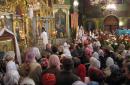
6. Peter and Paul Cathedral - the first stone temple of Salekhard. It was built in 1894 and has survived to this day almost in its original form.
7. Modern Salekhard is approximately the same as most economically secure northern “oil and gas” cities. Mostly new buildings, modern architecture, many cultural, sports and leisure facilities, and old houses have been renovated and brought into common architectural form.
13. There is a mosque in Salekhard, one of the northernmost in Russia. Behind the mosque are the buildings of the Yamal Multidisciplinary College.
14. National Library of the Yamal-Nenets Autonomous Okrug.
15. Modern urban development.
16. One of the unusual architectural objects of the city is the cable-stayed single-pillar bridge "Torch" across the Shaitanka River, opened in 2004. There is a two-story restaurant on the bridge pylon.
17. “In the fairy tales of ancient Yamal, in the songs of new generations - everywhere people honor deer with a word of gratitude!”
18. Not far from the cable-stayed bridge on the far bank of the Shaitanka there are administrative buildings of the Yamalo-Nenets Autonomous Okrug. This “government quarter” was built quite recently - the administration of the Yamal-Nenets Autonomous Okrug moved here in 2009.
20. Construction of a new Cathedral of the Transfiguration is underway next door.
21. Salekhard is located exactly on the Arctic Circle. In the place where the road to the airport crosses latitude 66°33`44``, a memorial sign has been erected. I wrote and thought, how many times have I been to and beyond the Arctic Circle? Now I’ll count - on 6 trips to the North and 1 time to the South in Antarctica.
22. Not far from the Arctic Circle sign, there is a monument to the 501st construction site, built by prisoners of the transpolar railway from Salekhard to Igarka. In the forests and tundras far from Salekhard, the remains of prisoner barracks, railway embankments and even old steam locomotives are still preserved. These places can be seen as part of a separate three-day trip. In the future, if I return to Salekhard, I will try to go there...
Meanwhile, the Transpolar Railway project is actually alive - albeit not in the same format as it was during the Gulag. In essence, part of this road from Chum and Vorkuta to Labytnang is operational; on the opposite bank, along the route of the former 501st construction site, the current railway from Urengoy to Nadym was built, they are about to begin active work on the Northern Latitudinal Railway, which will connect Nadym and Salekhard approximately along the route of the former 501st construction site. In recent years, projects on the bridge across the Ob River in Salekhard have again intensified. Bold projects are being voiced for the construction of a road east from Urengoy to the banks of the Yenisei in the Igarka region, and even more bold - to Dudinka and Norilsk, in order to connect the Norilsk industrial region by land with the “Big Earth”. Will all this ever be built? I think that they will build - not soon, not tomorrow, not in the foreseeable future, but I think that someday they will build - because this direction is strategically promising, modern construction technologies have stepped far forward compared to Stalin’s times, and the presence in these remote in the northern areas of many still undeveloped fields is a very serious incentive for the development of transport infrastructure. Of course, this is not tomorrow or in a year... But maybe in a few years ...twenty, in retirement, will you be able to travel from Moscow to Norilsk by train? :)) It would be damn interesting! In the meantime, we peer into the distance at the torn rails and the lives of the 501st construction site...
25. Then the road passes the airport and leads to the ferry crossings Salekhard - Labytnangi and Salekhard - Priobye. The first connects Salekhard with the opposite bank and the railway station, and the second - 630 kilometers along the Ob to the Ob region, where the nearest main road connected to the general road network of the country reaches the river. On the high bank near the crossing there is a huge mammoth and a memorial inscription in honor of the 420th anniversary of the city.
28. At the crossing Salekhard - Labytnangi it is very busy - ferries across the Ob go one after another.
Here the Ob, squeezed on both sides by mountains, narrows to two kilometers and turns east. In this section, for many years now, it has been planned to build a huge bridge that will connect Salekhard with the country’s railway network and along which the latitudinal northern highway will pass. The issue of the Salekhard Bridge has been floating around for many years, since the time of the 501st construction, and with varying degrees of activity it comes up from time to time in certain circles and authorities. Recently, conversations about the bridge have intensified again - in terms of some engineering solutions, for example, it is planned to use the experience of the Kerch bridge crossing that is currently being built. But this is still a question for the future.
33. And now on the banks of the Ob it is quiet and calm - in a wide stream the great Siberian river carries its waters to the Kara Sea among the harsh northern taiga and forest-tundra. From here to the beginning of the river delta it is a little more than a hundred kilometers, and to the mouth of the Ob in the area of the Nadym bar - 280 kilometers. A year ago I had the opportunity to visit Altai, at the very upper reaches of the river, and now we are very close to its mouth...
The journey ends - after standing on the banks of the Ob at the crossing, we go to the airport, where the plane to home is already waiting for us. It was great! Thanks Seryoga kitv for great company as always! And there are probably many other trips ahead, because there are so many interesting places in the world that are worth visiting! :))
The city of Salekhard (until 1933 - Obdorsk) is the capital of the world's largest gas producing region - the Yamalo-Nenets Autonomous Okrug. The only city on the planet located at the latitude of the Arctic Circle.
The history of Obdorsk-Salekhard goes back to the history of the development of the north of Western Siberia, the creation of statehood among the indigenous population, and the industrial development of the Arctic. Obdorsk was for centuries an outpost of the Russian state on its northern route to the Pacific Ocean.
After the annexation of Siberia to Russia, on the site of the Ostyak town, near the confluence of the Poluy and Ob rivers, the Russian Cossacks of the Berezovsky governor Nikita Trakhaniotov founded the Obdorsky fort in 1595. Obdorsk (in the Khanty language - Ob town) has experienced many transformations, always remaining the center of the region and an independent administrative unit. It contained the headquarters of Ostyak and Samoyed elders, representatives of the tsarist administration. Ostrog was renamed Obdorskaya Zastava in 1635. In 1799 the fortress was abolished. The outpost was transformed into the center of the Obdorsk volost of the Berezovsky district of the Tobolsk province - the village of Obdorsk.
 In 1897, in Obdorsk there were 30 houses, 150 trading shops, and there were 500 permanent residents who were mainly engaged in hunting, fishing and trading. Every year from December 15 to January 25, the famous Obdorsk Fair was held, the turnover of which exceeded 100 thousand rubles. Thousands of sellers and buyers came to it. Merchants brought here flour and bread, metal products and jewelry, cloth, wine and tobacco, and took away furs, walrus tusks, fish and bird feathers.
 After the formation of the Yamalo-Nenets National District in 1930, Obdorsk became its capital and in 1933 received a new name - Salekhard (from the Nenets “Sale-Kharn” - a city on a cape). In 1938, the district center acquired the status of a city.
Now it is a modern administrative, cultural and business center of the region. The city is provided with modern means of communication and telecommunications.
Recently, Salekhard has turned into a large worthwhile site. The housing shortage was one of the city's acute social problems. Therefore, the construction of residential buildings and social facilities became a priority. In the early 90s, there were only two dozen permanent houses in Salekhard; in 15 years the city was rebuilt almost from scratch.
Government of Yamal
 Romantics of the 70s.
  Arctic Circle Stele
 Road bridge


 Salekhard Airport
  Obdorsky fort


 City administration


 Yamal-Nedra


 Chubynina Street